LACA has been assisting the group VETO (Veto Energex Towers Organisation) since November 2008 when Energex indicated its intent to construct a powerline along Logan Reserve Rd , to cross the Logan River SEVEN times (involving 14 sites in total to be cleared along the Logan River ) , crossing the Geoff Philip Bridge to go east onto Waterford -Tamborine Rd and then west along the Camp Cable Road easement. The existing Camp Cable Rd powerline easement is now 20 metres wide and if upgraded will have a 33 KV line and a 110 Kv line that would need an easement of 40 metres wide (20 metres wider that what exists now along the southern side of Camp Cable Rd). The preferred route along the Logan River, Waterford-Tamborine Rd and Camp Cable Rd would be above ground and involved the removal of vegetation including endangered, of concern and not of concern remnant vegetation.
NATIONAL KOALA STRATEGY
The National Koala Strategy acknowledges that the status of the koala is vulnerable in South-east Queensland and least concern in the rest of the state as listed under the Nature Conservation Act 1992. The population of koalas in the Koala Coast in Redlands Council has been nominated for endangered status under the Nature Conservation Act 1992. The koala is a protected species in Queensland and cannot be taken, used or kept without a permit. The legislation notes the cultural significance of the koala and requires that government agencies consider the management measures necessary to conserve existing koala populations. Read more at this federal government biodiversity website
BIOREGIONAL CORRIDORS
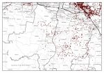
Throughout Queensland, the Department of Environment and Resource Management has identified areas of state or regional significance to preserve natural values of an area. These corridors are developed based on regional ecosystems (REs) and vegetation of both state and regional significance from data sourced from the Queensland Herbarium. There are two critical bioregional corridors that are impacted by this proposed Energex route.
- the Logan River bioregional corridor
- a 4 kilometre wide bioregional corridor (the centre of which is located approximately half way along Camp Cable Rd) which runs north to Stockleigh , Logan River , Chambers Flat, Munruben and Greenbank to connect up with the Flinders Peak to Karawatha Corridor and south to Munduloon Rd, Cedar Vale and Veresdale Scrubto connect up with the Birnam Range.